Athens is the capital and largest city of Greece. Her name comes from Athens, goddess of wisdom, worshiped in antiquity. Its history is deeply rooted in centuries and ancient Greek mythology. Athens gave the world some of the most famous writers, mathematicians and philosophers who introduced culture and art.
Where is Athens? Athens is located on the southeastern side of the Greek mainland.
The city is crowned by an ancient Acropolis which symbolizes the classical spirit and the largest architectural complex in the world. Old quarters, ancient buildings and cobbled streets stand and coexist with modern elements. Today, there are many tourist attractions that meet the high standards of other European cities.
The city covers 29 square kilometers, among which you can find many shopping centers, beautiful areas for relaxation, quiet streets for walks and historical districts to discover parts of the ancient city.
Interactive map of Athens
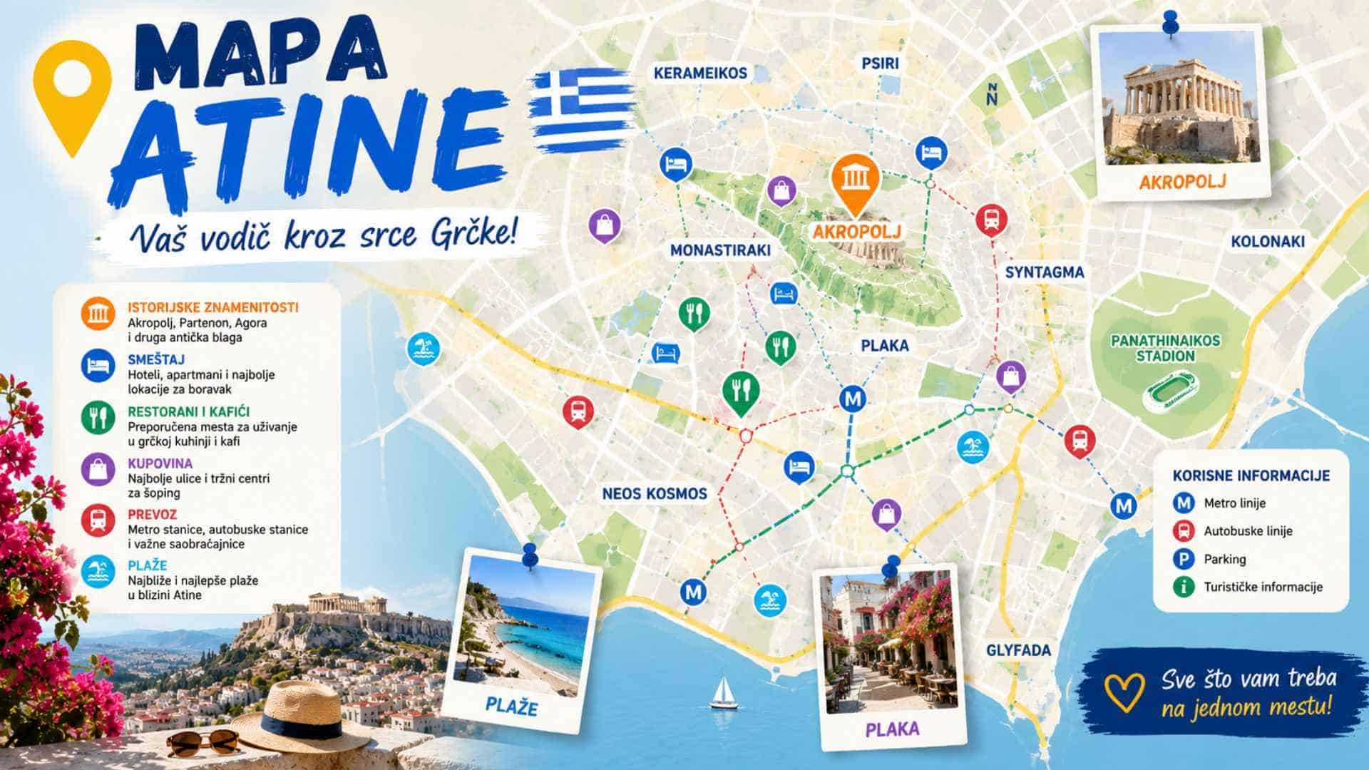
Landmarks, districts, ports and stations are marked on the map. The map opens in the center of the city, and you will see the airport, Rafina, the coast and Cape Sounion when you zoom out. Click on the dot for a short description and a link to our text.
Sights, neighborhoods and transport in Athens
Landmarks
- Acropolis - Parthenon and other temples on the rock above the city, under the protection of UNESCO.
- Acropolis Museum – A modern museum at the foot of the Acropolis, with original sculptures.
- Ancient Agora – The center of the ancient city, with the temple of Hephaestus.
- Temple of Olympian Zeus - Remains of one of the largest temples of ancient Greece.
- Panathenaic Stadium – The marble stadium of the first modern Olympic Games in 1896.
- Lycabettus Hill – The highest point of the city center, with a view of the Acropolis and the sea.
- National Archaeological Museum – One of the largest collections of ancient Greek art.
- Cape Sounion – Temple of Poseidon on the cape, in the south of Attica.
Neighborhoods and squares
- Syntagma - Main square, Parliament and changing of the guard.
- Plaka – The oldest quarter, narrow streets below the Acropolis.
- Monastiraki – Square and flea market, with a view of the Acropolis.
- Psyr – Cafes, taverns and nightlife.
- Kolonaki – An elegant district with boutiques, below Lycabettus.
Coast of Attica
- Glyfada – The most famous seaside suburb, with beaches and shops.
- Lake Vouliagmeni – Thermal lake for swimming on the coast of Attica.
Airport, ports and stations
- Athens Airport (ATH) - Eleftherios Venizelos International Airport.
- Port of Piraeus – Largest port, ferries to most islands.
- Rafina Port – The second port of Athens, with ferries to the Cyclades and Evia.
- Kifissos Bus Station – The main station of intercity KTEL buses.
- Larissa Railway Station – Main railway station, trains to Thessaloniki.
Most of the sights in the center are within walking distance, and for the rest, the metro is the most practical. More in the texts Athens Metro Network i How to get around Athens.
Distances from Athens Airport
The distances are calculated by road, and the driving time is approximate and without crowds. During rush hour and summer, expect significantly longer.
| Destination | Distance | Driving (approximate) |
|---|---|---|
| Rafina Port | 16 km | 25 minutes |
| Glyfada | 25 km | 35 minutes |
| Syntagma | 33 km | 35 minutes |
| Kifissos Bus Station | 40 km | 35 minutes |
| Cape Sounion | 46 km | 55 minutes |
| Port Piraeus | 49 km | 45 minutes |
Where to stay in Athens
- Plaka, Monastiraki and Syntagma - the best choice for a first visit, because all the main sights are within walking distance.
- Kolonaki – a quieter and more elegant neighborhood, close to the center.
- Piraeus – handy if you have an early ferry. More in the text Best hotel in Piraeus.
- You can compare offers for all parts of the city at Booking.
Frequently asked questions
How far is the airport from the center of Athens?
The distance to Syntagma Square is in the table above. Metro line 3 runs from the airport to Syntagma in about 40 minutes.
How to get from the airport to Piraeus?
By bus X96, which runs directly, or by metro with a transfer. More in the text Port of Piraeus.
How many days are enough for Athens?
Two to three days are enough for the main sights. With a trip to Cape Sounion or nearby islands, count more.
How to get to Athens